Pages

Thursday, April 30, 2015

Z: Zion Canyon


Hey, it's the letter Z, and the last day of the A to Z Challenge! I have managed to post every day, and only had to fudge a little bit to make each post match its letter and/or my theme. I apologize right now for having done less well at visiting other bloggers, but I promise I'll keep right on working through the list. I'll never get to everyone, but I'll visit a lot before the next challenge rolls around.

And now, to our last Mountains and Valleys feature, one of the great ones, Zion Canyon, the heart of Zion National Park. I had the privilege of visiting Zion just this month (while my first week of posts were on auto-pilot!), not for the first time and I hope not for the last time.

Some basic info:
Zion Canyon was carved by the Virgin River. But the history of this desert canyon is water all the way back. The spectacular red cliffs are sandstone--laid down by an ancient sea. The canyon bottom is around 4000', with cliffs of 2000' or more leading up. And at the head of Zion Canyon, you enter the Virgin River Narrows, a slot canyon where you can see on any day the power of water--and a reminded to stay out of there when thunderstorms are in the region!

The park is located about 40 miles east of St. George, Utah, and was named by early Mormon pioneers. If it had been Norwegians, it would be Valhalla Canyon, because it's just that sort of place--it makes you figure it must be the home of the gods.

Without further ado, because a picture is worth a thousand words:
Overlooking Zion Canyon from the West Rim area (off Kolob Terrace Road).
Zion Canyon from the Observation Point trail.
Zion Trails are often not for the faint of heart. This is one of the more unnerving parts of the famous Angels Landing Trail.
One of the most beautiful things in the world is a cottonwood in leaf against the red canyons of the Colorado Plateau (the Utah canyon country). A ray of light hit just as we entered the Virgin River Narrows.
Hiking the Narrows. The water is very cold feeling in the morning, and deliciously cool by noon on a June day! You can see why you don't want to be here during a flash flood.

 ©Rebecca M. Douglass, 2015


Wednesday, April 29, 2015

Y: Yosemite


Y is for Yosemite, which is not only the 3rd or 4th US National Park created, it is also the name of one of the most spectacular valleys anywhere, the Yosemite Valley.

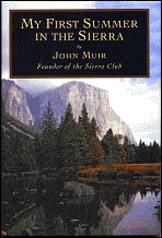
And when I think of Yosemite, both Valley and mountains, I think of John Muir, and My First Summer in the Sierra.
2116294  11074359  238727  1671548

I thought I'd share just a few of the many covers this one has, having been produced in about 50 editions since it was first published in 1911. Looking at them reminds me how long it's been since I last read the book, and that I need to dip back into it again. Based on the diaries Muir kept when he first entered the Yosemite Valley in 1869 as guide to a flock of sheep (the very things he himself called "hooved locusts), My First Summer records his reactions to the magnificent scenery he fell in love with an worked all his life to save. There is a bit of preaching in the book, and a bit of philosophy, some historical insights, and a touch of adventure. At times his prose waxes a bit too poetic for modern tastes, but it is always worth reading.

The Yosemite Valley--and the surrounding high country--is always worth visiting.

Yosemite Valley from the Yosemite Falls trail.
 There is a good reason I didn't include a photo of the falls from that hike: it was October, and there was no water going over the falls. None.
Half Dome from the Valley floor. Boys doing what small boys do in gorgeous places.
Vernal Falls. Note the water spots on lens--they don't call it the Mist Trail for nothing! This was in June, when run-off was at its peak. A week later, 3 hikers were swept over the falls after ignoring signs about not wading or swimming in the river above the falls. Believe those signs!
Nevada Fall and Liberty Cap.
Yosemite high country--looking back toward the Valley from the Tioga Pass road.

©Rebecca M. Douglass, 2015


Tuesday, April 28, 2015

Xavier Xanthum: X Marks the Spot


I checked our huge world atlas, and found no mountains starting with X. There are rivers in China, of course, but I don't know anything about them, so instead of doing research, I returned to my favorite space explorer, expressly invented for my first A to Z Challenge...Xavier Xanthum, Space Explorer! Here, at half-flash size (just over 500 words) is a bonus fiction feature. I couldn't find any photos...

 Xavier Xanthun: X Marks the Spot

The Wanderlust gave a terrific lurch as it entered the atmosphere, and Xavier Xanthum, Space Explorer, felt his body stretch the crash straps as they decelerated at far more than the usual rate. He didn’t even have time to ask the computer what was up before another bump indicated that they were on the ground.

Xavier sat back and ran a hand under the straps to ease the tightness. “Larry? What was that all about?”

“My apologies, Xavier.” The computer’s voice sounded mechanical, which meant he was busy with other tasks. “The ground occurred a great deal sooner than anticipated.”

Xavier sat and worked that out. “The atmosphere was thinner than you expected?”

“Not precisely. There appeared to be an extrusion from the planet’s surface at this point. It was not on any charts.”

“We have charts for this planet?”

The computer fell silent for a minute, then the floating eyeballs that were Larry’s preferred manifestation appeared next to Xavier, who had started to unbuckle his safety straps. “You might not want to do that just yet. I am attempting to access charts. There appears to be some kind of local communications system.”

Xavier felt a stir of interest and concern. Inhabited planets were exciting. Often, too exciting. You never knew what might bite you.  An inhabited planet that wasn’t indicated as such on any charts was particularly worrisome. “What are you getting?”

Larry hesitated before answering. As a computer, he did not need to pause to marshal his thoughts, but Xavier had noticed that Larry liked to do so anyway. “The local sub-ether information system has provided a map.”

“Great! So what does it tell us?”

A moment later a map grid appeared on Xavier’s viewscreen. It showed a few concentric contour lines with an X in the center, the lines getting very close together indeed near the edges, indicating steep slopes in all directions. A little flag read, “You are here.”

“Zoom out, Larry. We need some context.”

Again, that odd pause before Larry answered, his tone completely flat and mechanical. “It will not zoom out. Attempting again.”

Xavier watched in fascination as the image fluttered a bit, and the flag was replaced with another text, rendered as “X marks the spot.”

“What spot would that be, Larry?”

“I believe it is the spot where we are.”

“How very helpful, Larry.” Sarcasm was wasted on the computer, but it made Xavier feel better.

“Would you like to attempt to explore further?”

Xavier gave it some thought. The planet was inhabited. The inhabitants had communications systems, which they used, apparently, to communicate as little as possible. His mind drifted off to the last planet they had visited, where settlers had built a lovely little resort by a warm ocean. “Let’s just go back and mark our X on that beach again,” he said, a little dreamily. He settled back in his chair, and the eyeballs lingered on him as his eyes closed, a smile playing about his face.

After take-off, Larry made some adjustments to the interplanetary chart. Hereafter, travelers would know that this world featured a very high mountain that went by the name of X. And some rather unhelpful inhabitants.
###

©Rebecca M. Douglass, 2015

Monday, April 27, 2015

W is for Waterless Mountain (a middle-grade Classic).


1195394
Title: Waterless Mountain
Author: Laura Adams Armer
Publisher: Originally published by Longmans, Green & Co., 1931, 212 pages.
Winner 1932 Newbery Award

Source: Library ebook

Summary: 
The book traces the life of Younger Brother as he grows from about age 9 to perhaps 16 (?), learning the ways of his Navajo people and learning to be a Singer, a medicine man. Along the way he and his family journey to the Pacific and back, and he learns the important songs of his people.

Review: 
It is easy, in reading this, to tell that the book is old. I doubt something written in this style would be published today, let alone given the Newbery. That would be our loss. Although the book sometimes veers from story to anthropology, to me it reads smoothly and easily however you look at it. While much of the story feels like a device on which to hang the explanation of Navajo culture, in the end I don't think that's a bad thing. And we do gradually get to feel a connection with Younger Brother (how much of the struggle with that comes from not using a name? I'm not quite sure about that and how it fits the traditional culture), so that in the end we care deeply that he finds his way and learns to become a medicine man.

I did do some research and Laura Adams Armer was an artist and photographer, and an amateur anthropologist who lived among the Navajo for many years, and managed to persuade them to allow her to witness ceremonies, photograph and paint sacred sand paintings, and so forth. I couldn't find any analysis that confirms that her depictions of the religion and culture are accurate, but they ring true to my limited knowledge.

Recommendation:
Probably for adults and somewhat older children, due to the writing style, though some children might get into it. There is little action in the plot, and that might put some kids off. But for anyone interested in Navajo culture, it's a worthwhile read.

Full Disclosure: I checked Waterless Mountain out of my digital library, and received nothing from the writer or publisher in exchange for my honest review.  The opinions expressed are my own and those of no one else.  I am disclosing this in accordance with the Federal Trade Commission's 16 CFR, Part 255: "Guides Concerning the Use of Endorsements and Testimonials in Advertising."


I am a huge fan of the Navajo lands, and in fact the whole Southwest. I couldn't figure out exactly which mountain is the Waterless Mountain, but I noticed that the family lived somewhere in the region of Canyon de Chelly. So...I can hit a mountain and a valley (a canyon, at least) in one post!

We visited the area in 2012, and hiked down to the White House ruins in Canyon de Chelly (I believe that is the only place you are permitted to enter the canyon without a guide). This is the spot depicted on the cover of the book.

In order to get an early start (and because it's what we do), we camped at the private Spider Rock Campground on the rim of the canyon, run by a Navajo family. You can rent a hogan for the night if you want--this would be the traditional house that all the Navajo in the book live in, though today most have more conventional homes (which may not be as well adapted to the climate!). We didn't rent a hogan, since we go prepared to camp and are royal cheapskates). I can recommend the camp; it's not fancy, but it was clean and quiet.

And while some find the Southwest to be bleak desert, it is stunningly beautiful in my eyes, and even in mid-summer is cool and pleasant in the early hours.


Like the country? Want to read more about the people and places? For adults, I can strongly recommend the mysteries of Tony Hillerman!

©Rebecca M. Douglass, 2015

Saturday, April 25, 2015

V is for...Volcanoes


I tossed this one around for a while, and the only mountain I came up with was the Vinson Massif.  Which is actually totally cool. I mean, the Vinson Massif is the high point of Antarctica, at 16,050'. It's not a technically difficult climb, aside from being in Antarctica, which adds more than enough challenge. It is almost all glacier (big surprise) with a bit of rock sticking out of the top.

But right now, volcanoes are my focus. They are in the news, of course, with Chile's Calbuco volcano erupting. That volcano is part of the Ring of Fire, the circle of volcanoes (and earthquake zones--the two are, of course, related) all around the Pacific.

I grew up with volcanoes. Mt. Rainier was "our" volcano, the one we could see from our house (though happily far enough away that we'd be okay if it erupted. Probably).
Mt. Rainier from the Wonderland Trail, looking over the Winthrop Glacier to the cloud-wrapped summit.
But of course the whole range is volcanoes. If you start at Mt. Baker near the Canadian border, and count them all down to Mt. Lassen in northern California (the southernmost of the Cascades), there are about 15 major volcanoes. The range actually extends on up into British Columbia, adding 5 more.

These volcanoes are the result of plate tectonics, as three minor plates along the western edge of the continent dive beneath the North American plate. That subduction zone creates both earthquakes and places where the molten rock forces its way back up through the surface--volcanoes. In the millenia since the mountains formed, all have been shaped and carved by glaciers, as well.

Glacier Peak

And these Cascade Mountain are, for the most part, live volcanoes. The most recent eruption, of course, was Mt. St. Helens in 1980. In 2005, on our way to Seattle, we  noticed that it was a very clear day and detoured to the Clearwater Ridge Visitor's Center for a nice view of what was left of the mountain. The wind was howling so hard our kids, then only 6 & 8, couldn't stand up!

Not steam or ash this time, but clouds and blowing snow.

Before St. Helens, the most recent eruption was Lassen, in 1917. But Glacier, Baker, Rainier, Hood, and Shasta have all erupted within the last 2-400 years.

In 1989 I climbed Mt. St. Helens, or what was left of it. Lousy weather conditions made for poor visibility as well as photography, but we did see down into the crater, to where the mountain was already working at rebuilding:
This is a view out the blast zone, where the mountain vaporized its own side.
In 1988, I climbed Mt. Adams with some friends. Though 12,280', it isn't a particularly technical climb, though we did use ice axe and crampons for security on the high slopes.
Mt. Adams "Base camp", also known as The Lunchcounter. Note the high-fashion long underwear-and-shorts combo. This was the 80s, for sure (though I have to say the combo made a lot of sense in the conditions in Washington).

Mt. Adams summit. I believe that in the end we went up the bare slopes, for the most part, but came down the snow in a couple of long glissades that took the seat out of my pants!


Friday, April 24, 2015

U: Ubehebe Crater (Flash Fiction)


U is for Ubehebe Crater. Partly just because I like to say it (pronounce all the letters: you-bee-hee-bee. Fun). Since it's Friday, it's also a Flash Fiction day, and I combined this with the Chuck Wendig weekly writing challenge--this time, to pick an opening sentence from some 400 posted last week by his readers. I read them until I found one that I thought fit my peak of the day, and wrote 750 words (even though Chuck gave us up to 2000 this time, I thought I'd keep it a little shorter for the A to Z folks). The sentence, which I took the liberty of modifying into two sentences, was by Ada Ireland.

Ubehebe

They say to err is human, to forgive divine. The second half of that saying is a complete lie. Consider the incident at Ubehebe Crater. That sounds like the title of a Hardy Boys mystery, but it was deadly serious to me. Unfortunately for me, it was equally serious to the gods involved.

I don’t even know exactly which gods were there. Probably Pele; it is, after all, a volcanic crater. But she wasn’t alone, not by a long chalk, and none of the gods did much forgiving that day.

After saying so much, I suppose I’d better tell you the whole story. See, I went there because I’d heard there were some interesting things living in the silty mud puddle at the bottom of the crater. And I went at night, because I didn’t have the proper permits for my research, and National Parks are a bit fussy that way. I suppose that was my first all-too-human error: thinking my work was more important than the rules.

But that was a human error with human consequences. It was the other error that led to the real trouble.

When I got to the rim of the crater, there was no one around. It wasn’t closed, exactly, because there aren’t any gates or anything. But there isn’t much point in sight-seeing in the dark, and with the tourists long gone to their dinners and beds, there were no rangers, either.

The wind was blowing hard on the rim, as it usually does in the spring. I knew it would be better once I was down in the crater, so I grabbed the pack with my research equipment and headed down the trail fast. I didn’t bother with a light, since there was enough moonlight to see my way, and nothing much to trip over.

I got to the bottom, and sure enough, there’d been just enough rain to maintain puddle down there. It’s a shallow mess of this incredible red silt, so fine it pretty much just stays suspended in the water. Just in case the creatures were light sensitive, I scooped up a bunch of the muck into my specimen containers before I turned on my headlamp. No one would see my light unless they were on the rim, so it was safe enough now.

That was my next and more serious error. I assumed that human observers were my only worry. I happily shone my light into the selected muck, and studied the creatures wriggling in the red silt. Sure enough, those were like nothing I’d ever seen. I couldn’t wait to get a few back to the lab and study them.

I didn’t want to endanger any rare species, so I selected just four specimens and returned the rest to their mud puddle. Stowing the others in my pack, I turned to go.

And came face to glowing face with something that I could only vaguely comprehend.

“You would steal our young?” The voice echoed and boomed, though I think the sounds were confined to the inside of my head.

I opened my mouth, and the entity waved an appendage. “There can be no defense. Return the spawn to their nest!”

I was a little slow to work that out, and before I could figure it out and remove my pack again, the being chose to nudge me along with a bit of a lightning bolt. I thought it was only Zeus who did that, and maybe Odin. But this deity—and I had no doubt that I had offended whatever god rules over the desolate volcanic lands of Death Valley—was well-armed. When I turned and thought about trying to escape, I heard voices echoing all around me, warning me to stand. She—he?—wasn’t alone.

Very carefully, I removed my pack, took out the specimen bottles, and released the strange squigglers back into their muck. Then I turned to climb out of the pit. I’d done what they asked, and promised aloud to leave and never come back. No harm, no foul, right?

Wrong. The gods don’t forgive. They are rather more interested in vengeance.

#

My puddle is drying fast under the desert sun. If there is no more rain, the water will all be gone in another two days, and I will die, for a frog requires water. The squigglers have vanished; I don’t know how or where.

I wonder if they have discovered my car yet, and what the rangers will think. I don’t think the gods left a note.
###


Ubehebe Crater is in the north end of Death Valley, not far from Scotty's Castle. It is the blown-out remains of a small volcano, which spewed cinders all around before and during the massive steam explosion that changed it from a cone to a crater. It is 600 feet deep and a half mile across.
Ubehebe Crater in 2005. You can see the puddle in the bottom; there was no water down there in April 2015!

Yes, there are strange little wigglers in that puddle, or there were in 2005.
©Rebecca M. Douglass, 2015

Thursday, April 23, 2015

T: Telescope Peak


Also Treasure Mountain, by Louis L'Amour, because I can!

First, Telescope Peak. Telescope Peak is the peak that stands on the West side of Death Valley, and towers over Badwater (the lowest spot in North America). It is 11,048' high, which puts it 11,331' above the view of it from Badwater (282' below sea level). Straight line between the alkali flats and the summit is 20 miles, so that's a lot of relief!

In spring of a good year (i.e. one when CA has seen some precipitation), the summit of the peak is buried in snow even when the bottom of the Valley is scorching. The trail, 14 miles round trip from the road's end at Mahogany Flat campground doesn't usually become passable without crampons and winter gear until mid-May.

 It's hard to get the color right--the salt at Badwater is white like snow, which is always hard to shoot.
Badwater and Telescope peak. 1998 was a wet year, reflected in the heavy snow cover (and great wildflowers down below).

Now for the book review:

282092 

Title: Treasure Mountain
2068755Author: Louis L'Amour
Publisher: Bantam, 1972. 192 pages
Source:  library (digital)

Summary: Louis L'Amour invented the Sackett family and, eventually, tracked their history through 2 or 3 centuries though most of the books were of course set in the Frontier West period. In this book, Tell and Orrin Sackett are on a quest to find out what happened to their father, who disappeared into the west 20 years before. The quest starts in New Orleans, but ends in the San Juan Mountains of Colorado, with (of course) a great deal of struggle and not a few good fights along the way.

Review:
I can't review a book like this as though it were Anna Karinina. L'Amour's westerns were never meant to be great literature, and they aren't. Sometimes they aren't even very well written (though this one seemed more free than most of the kinds of flaws that annoy me), but most are reasonably well plotted and all are delightfully embarrassing to love. 

Recommendation: For anyone who loves Westerns, and hopeless romantics.


Full Disclosure: I checked Treasure Mountain out of my digital library, and received nothing from the writer or publisher in exchange for my honest review.  The opinions expressed are my own and those of no one else.  I am disclosing this in accordance with the Federal Trade Commission's 16 CFR, Part 255: "Guides Concerning the Use of Endorsements and Testimonials in Advertising."


Wednesday, April 22, 2015

S: Skunk Mountain


Today's mountain is...Skunk Mountain. Because I warned you I'd talk about my own books some.


The Ninja Librarian and Return to Skunk Corners (and an as-yet untitled 3rd book still being drafted) are set in the town of Skunk Corners, which sits on the side of an entirely fictional mountain called...you guessed it! Skunk Mountain. 

These books are tall tales in the spirit of (in my most egotistical dreams!) Mark Twain or Richard Peck or Sid Fleishmann. The setting is deliberately vague, but clearly something Western, and in my mind probably best matches the western foothills of the Sierra Nevada mountains, though the Colorado Rockies work quite well too.

Skunk Mountain is no dramatic volcano. It's just another hill, really, which Big Al, the narrator, can climb in a single afternoon (though not necessarily descend the same day, but that's another story!). It is bald on top, and may be of volcanic origin, as their is a field of jumbled basalt rocks near the town (that would seem to let out Colorado, but never mind). 

And, as the name implies, the mountain is home to many critters, but especially to skunks, who sometimes play a significant role in events in the town.

In addition to the books, you can find tales from the town and mountain on my short fiction page, as well as in the BookElves Anthology. Many of these tales are in the voices of other people from around town, not just that of Big Al. Even the ever-mysterious Ninja Librarian has consented to share a few stories!

So what does Skunk Mountain look like? It varies a bit, even in my head. Sometimes it looks like this, but probably with more pines than oaks, and a bit thicker vegetation:

I think this is actually in West Texas--Big Bend or Guadalupe Mtn.
It might be more like this, though there's no big meadows in Skunk Corners.
Leavitt Meadows, near Sonora Pass, CA
I can see stuff like this on the slopes of Skunk Mountain.
Boulder county, CO open space
And the view from the top might be something like this, only probably with less cool granite.
Near Carson Pass, CA
Mostly, Skunk Mountain is whatever your imagination says it is, while you are reading the books!

©Rebecca M. Douglass, 2015


Tuesday, April 21, 2015

R is for Mount Rainier (YA Review: The Honest Truth)


22571259

Title:The Honest Truth
Author: Dan Gemeinhart
Publisher: Scholastic Press, 2015. 229 pages.  Young Adult (?)
Source: Library

Summary:
Mark is sick, really sick, and he has just one thing he feels like he has to do. He wants to climb Mt. Rainier, if he dies trying. So he runs away to do it, taking only the bare essentials and his dog.


Review:
This book caught my eye while I was shelving at the library, first because of the cover, and then the blurb, because I'm from the Northwest and Mt. Rainier is even still (after nearly 30 years), "The Mountain."

The title is good, because this mostly first-person narrative doesn't pull any punches. Cancer sucks, and Mark isn't under any illusions about that, or his long-term chances, and he tell us what he's feeling. I don't know if the author meant it that way, but when I read the list of supplies Mark is carrying to the Mountain, I really did feel like it was deliberately a suicide journey, though it might have been more about him not having any experience (not sure if the author does, either, because it's not always clear if he sees the gaps either).

This book falls squarely into the "kids with cancer" genre which seems popular these days, and doesn't lack any of the emotional force--or manipulation--of that story line. But it was a good read, and had a few elements I really liked. For one, Mark writes his journal--and notes to his best friend--in haiku. He's a little obsessive about it, but it is a nice touch, and maybe symbolic, too, given that he must also live his life inside some very strict parameters.

It is also, of course, a rather literal "journey of self-discovery," and I think works very well at that. The Mark of the final chapter is not--exactly--the Mark of the first chapter.

Recommendation:
I'm not sure why our library put this in Young Adult. It didn't seem to be to deal with any harder issues than a lot of books in the Juvvy section, and there is no sex or sexual innuendo. Only a lot of anger and sadness. The age of the protagonist is never made clear (that I caught--though there is some backstory that would allow me to figure it out, I think). I would say The Honest Truth is suitable for  kids from maybe 11 or 12 up. The reading level isn't hard, but the subject matter (in particular the sense that the narrator has given up--though that is redeemed, too) might be too heartbreaking for the littler kids (so on reflection maybe that's why YA, since if it's in Juvvy it's apt to be picked up by kids as young as 8).

Full Disclosure: I checked The Honest Truth out of my library, and received nothing from the writer or publisher in exchange for my honest review.  The opinions expressed are my own and those of no one else.  I am disclosing this in accordance with the Federal Trade Commission's 16 CFR, Part 255: "Guides Concerning the Use of Endorsements and Testimonials in Advertising."


And here's Mark's mountain, on a better day than when he visited!

This is the opposite side from where Mark went.

Monday, April 20, 2015

Q: Quandary Peak


For the letter Q, which I thought I might have trouble filling, I bring you: Queets Mountain, the Quinault River (valley), and the Quilcene range, all part of the Olympic Mountains in Washington state (see "O"). Also Queen Charlotte Sound, which is in British Columbia, along the coast and is more or less a fiord--which I would say fits the "mountains and valleys" theme.

But most of all, I bring you Quandary Peak, Colorado. Why? Because it's the first I climbed that was over 14,000'. Actually, though I spent many nights last summer over 14,000', Quandary is still the only summit I've been on that was up so high.

So here it is, even though as peaks go, it's not really anything wildly special. Except they all are.

Elevation: 14,271'
Location: Colorado, USA. Rocky Mountains, near Breckenridge
Climb: trail walk
When: I climbed it in Sept. 2012, with a large party of friends from an internet backpacking forum. Several of us had flown from sea level the day before. I don't recommend that.

Quandary is the 13th highest of the 53 Colorado summits over 14,000'

Nice reminder. It's a walk, but things happen at high elevations.
Running out of trees. What you see up above is...almost...the summit.
There was a lot of company on the trail. Some of it was better-looking than others.
The scene on the summit.
Our gang on the summit. I can't help noticing that the sign has the elevation wrong.
Literary tie-in: not this peak, but the Rockies of Colorado. Check out A Lady's Life in the Rocky Mountains by Isabella Bird. She was a 19th-Century adventurer, who at home was too sick to do anything, but somehow managed to travel the world, ride horses up the Rockies, and climb some of their summits. She wrote a number of books about her travels--what we today would call Adventure Travel (it all was, then!).

©Rebecca M. Douglass, 2015